Rand McNally 2024 Road Atlas 100th Anniversary Collector's Edition
$19.99

FREE Shipping over $99
Estimated delivery in 5-7 days
Estimated delivery in 5-7 days
- This item is currently not available
- Delivery to Change Address
- Delivery Fee Details
This item is excluded from all discounts and promotions.
Minimum order quantity of
1
Maximum order quantity of
100
Must purchase in increments of
1

Return Policy
We believe in offering the very best value, quality, and selection. Plus, we want you to enjoy your purchase! In the event you wish to send a product back to us, you may return most unused items for a refund or exchange, minus shipping, within 90 days from the date of purchase unless noted below under exceptions and exclusions. Refunds are issued to the original form of payment.
Features
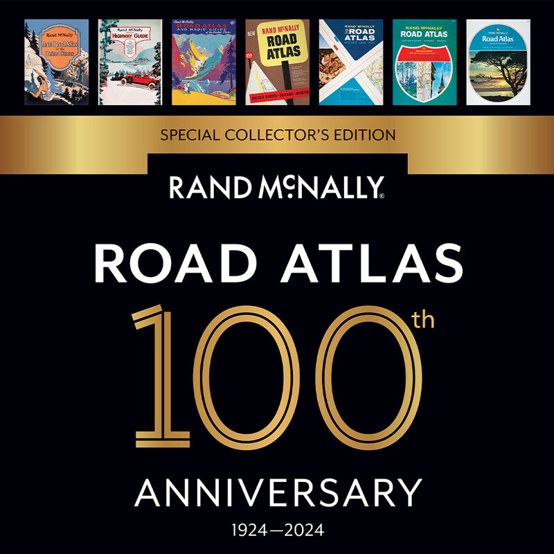
Beginning with its predecessor, the Auto Chum in 1924, the Rand McNally Road Atlas has been the essential, trusted tool for road travelers for 100 years. Celebrating its centennial anniversary, this 2024 Special Collector's Edition features a trip down memory lane – a nostalgic look back at 100 years of roadside culture, cars, and the highway system that shaped the open road, as well as showcasing Road Atlas covers throughout the years.
• This updated 2024 edition contains maps of every U.S. state and Canadian province, an overview map of Mexico, and detailed inset maps of over 350 cities and 20 national parks.
• Road construction and conditions contact information for every state conveniently located above the maps.
• Contains mileage chart showing distances between 90 North American cities and national parks along with a driving times map.
• Tourism websites and phone numbers for every U.S. state and Canadian province on map pages.
• Dimensions: 10-7/8" x 15-3/8"
• Page Count: 144
- Celebrating the centennial anniversary of the trusted Rand McNally Atlas
- Nostalgic look at 100 years of roadside culture, cars, and the highway system
- Maps of every U.S. state, Canadian province, and overview of Mexico
- Detailed inset maps of over 350 cities and 20 national parks
- Tourism websites and phone numbers for every U.S. state and Canadian province
Specs
Unit Weight
1.20 lb
Brand
Rand McNally
MFG Part No.
0528027182
 800-700-1366