
Garmin GPSMAP 943 Chartplotter - Preloaded US+Canada+Bahamas BlueChart g3 - LakeVu g3
$1,299.99

FREE Shipping
Estimated delivery in 5-7 days
Estimated delivery in 5-7 days
- This item is currently not available
- Delivery to Change Address
- Delivery Fee Details
This item is excluded from all discounts and promotions.
Minimum order quantity of
1
Maximum order quantity of
100
Must purchase in increments of
1

Return Policy
We believe in offering the very best value, quality, and selection. Plus, we want you to enjoy your purchase! In the event you wish to send a product back to us, you may return most unused items for a refund or exchange, minus shipping, within 90 days from the date of purchase unless noted below under exceptions and exclusions. Refunds are issued to the original form of payment.
Features
GPSMAP; 943 Chartplotter - Preloaded US+Canada+Bahamas BlueChart; g3 - LakeVü g3
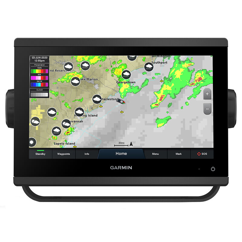
Get a sharper view from your connected helm with the GPSMAP; 943 chartplotter. Its higher-resolution 9” in-plane switching display has 50% more pixels than previous-generation touchscreens. The ultrasleek design and nearly double the processing power of previous-generation GPSMAP devices offer seamless integration into your Garmin marine system. Preloaded BlueChart; g3 coastal charts and LakeVü g3 inland maps give you the best of Garmin and Navionics; data — with built-in Auto Guidance1 technology for confidence in helping you get where you need to go. Easily build your marine system — from compatible sonar and autopilots to compatible radar, cameras and multimedia — using HTML 5.0, NMEA 2000; and NMEA 0183 network connectivity, J1939 for engines and the Garmin Marine Network. Add Panoptix; FrontVü forward-looking sonar2 (sold separately) for help in avoiding underwater obstructions ahead. Or pair your plotter with your other compatible Garmin devices, such as quatix; marine smartwatches, wind transducers, wireless remote controls and more.
Features:
- Higher-resolution in-plane switching touchscreen displays offer improved sunlight readability and visibility from any angle, with 50% more pixels than previous-generation 9” units
- Fast and responsive, with nearly twice the processing power of previous-generation GPSMAP; devices, this system references 10 Hz GNSS (GPS, GLONASS and Galileo) for accurate positioning and smooth speed as well as COG data
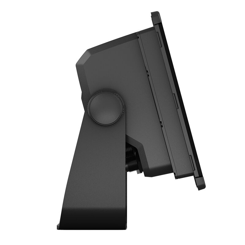
- Slimline display borders, edge-to-edge glass and reduced unit footprint make for easy retrofit in a wider range of dash configurations
- Preloaded mapping includes LakeVü g3 and BlueChart; g3 with the best of Garmin and Navionics; data plus built-in Auto Guidance1 technology for confidence in helping you get where you need to go
- Built-in Garmin SailAssist; features, including laylines, race features, set and drift, wind data and more3
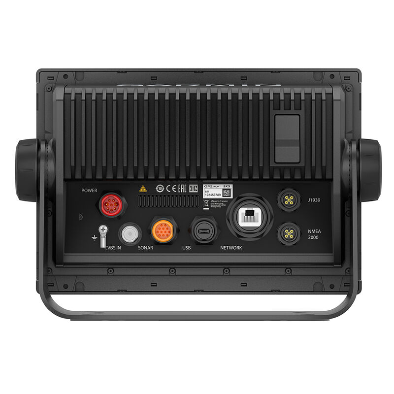
- J1939 engine connectivity for easy integration with engines and our exclusive OneHelm; feature for connecting to compatible third-party devices, such as EmpirBus; digital switching
- Easily build your marine system — from compatible sonar and autopilots to compatible radar, cameras and multimedia — using NMEA 2000; and NMEA 0183 network connectivity and the Garmin Marine Network
- Use built-in Wi-Fi; networking to pair with the free ActiveCaptain; app3 for access to OneChart;, smart notifications, software updates and more
- Integrated ANT; technology support for use with your compatible quatix; marine smartwatches, gWind; Wireless 2 transducer, GNX; Wind marine instrument and wireless remote controls
1 Auto Guidance is for planning purposes only and does not replace safe navigation operations
2 The ability to effectively avoid forward collisions with FrontVü sonar decreases as speed rises above 8 knots
3 Requires compatible wind transducer (sold separately)
4 Requires app on your compatible smartphone; see Garmin.com/ble
Wi-Fi is a registered trademark of the Wi-Fi Alliance.
- Screen Size: 9"
- Internal Antenna
- Touchscreen
- Cartography Brand: Garmin
Specs
Unit Weight
7.75 lb
Brand
Garmin
MFG Part No.
86457
 800-700-1366