Garmin BlueChart g2 Vision - Bristol Bay to Kotzebue Sound
$349.99

Shipping
FREE In-Store Pickup
Select store
- Ships from vendorThis item is currently not available
- Delivery to Change Address
- Delivery Fee Details
This item is excluded from all discounts and promotions.
Minimum order quantity of
1
Maximum order quantity of
100
Must purchase in increments of
1

Return Policy
We believe in offering the very best value, quality, and selection. Plus, we want you to enjoy your purchase! In the event you wish to send a product back to us, you may return most unused items for a refund or exchange, minus shipping, within 90 days from the date of purchase unless noted below under exceptions and exclusions. Refunds are issued to the original form of payment.
Features
Get a fresh perspective when you take to the water with BlueChart g2 Vision. With BlueChart g2 Vision data, you'll get detailed marine cartography that provides convenient viewing of nautical content and other premium features.
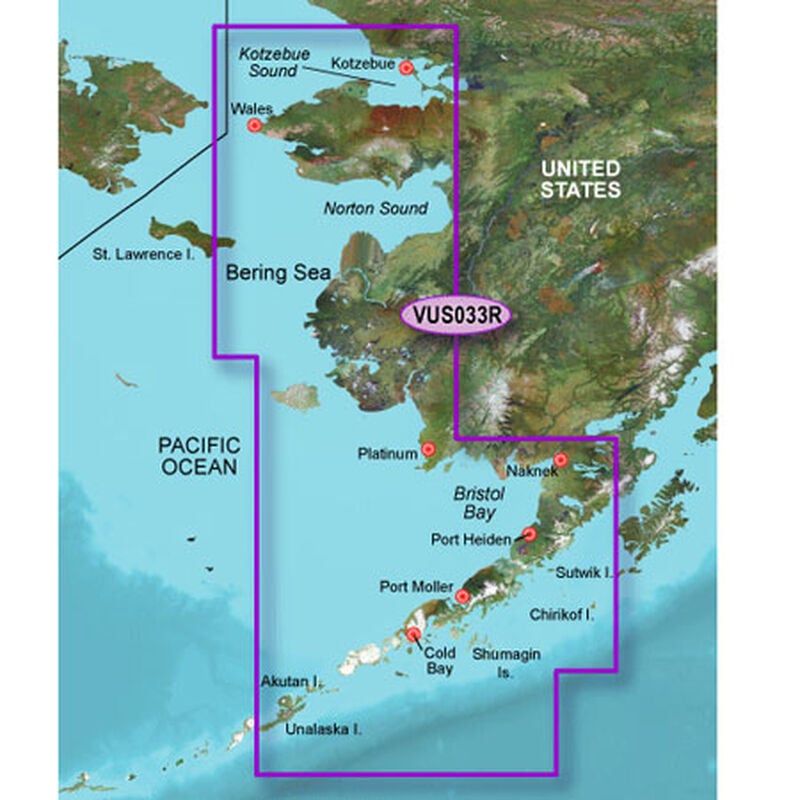
Covers Bristol Bay and the Alaska Peninsula from Sutwik Island to Kotzebue Sound, including Dillingham, Kvichak Bay, Port Moller, Chignik Bay, and Norton Sound. Also covers the Aleutian Islands from Unalaska Island to Unimak Island, including Akutan and Unimak Pass.
Realistic navigation features showing everything from shaded depth contours and coastlines to spot soundings, navaids, port plans, wrecks, obstructions, intertidal zones, restricted areas, IALA symbols and more.
Smooth display presentation including seamless transitioning between zoom levels and more continuity across chart boundaries.
Safety shading allows user to enable contour shading for all depth contours shallower than user-defined safe depth.
Fishing charts to help scope out bottom contours and depth soundings with less visual clutter on the display.
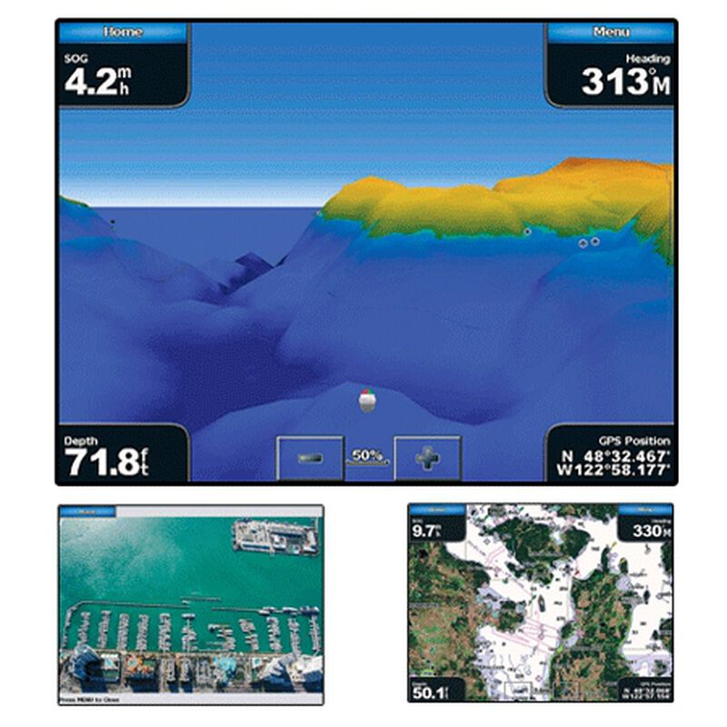
High-resolution satellite imagery, when overlaid on the chart, provides the mariner with a realistic view of the land and water for unparalleled situational awareness.
Aerial reference photography provides "real world" photos of ports, harbors, marinas, waterways, navigation landmarks and other points of interest, offering the mariner another powerful tool for navigating unfamiliar waters.
MarinerEye view 3-D perspective provides a bird's eye view from behind the boat showing the chart information for a quick, reliable and easy position fix.
FishEye view 3-D perspective provides an underwater view that visually represents the sea floor according to the chart's information.
Auto Guidance technology searches chart data to suggest the best passage to a destination. Includes tides, currents, marine services, coastal roads and points of interest.
BlueChart g2 Vision is compatible with Garmin's 7000, 6000, 5000, 4000, 700, 500, and 400 series chartplotters
Covers Bristol Bay and the Alaska Peninsula from Sutwik Island to Kotzebue Sound, including Dillingham, Kvichak Bay, Port Moller, Chignik Bay, and Norton Sound. Also covers the Aleutian Islands from Unalaska Island to Unimak Island, including Akutan and Unimak Pass.
Realistic navigation features showing everything from shaded depth contours and coastlines to spot soundings, navaids, port plans, wrecks, obstructions, intertidal zones, restricted areas, IALA symbols and more.
Smooth display presentation including seamless transitioning between zoom levels and more continuity across chart boundaries.
Safety shading allows user to enable contour shading for all depth contours shallower than user-defined safe depth.
Fishing charts to help scope out bottom contours and depth soundings with less visual clutter on the display.
High-resolution satellite imagery, when overlaid on the chart, provides the mariner with a realistic view of the land and water for unparalleled situational awareness.
Aerial reference photography provides "real world" photos of ports, harbors, marinas, waterways, navigation landmarks and other points of interest, offering the mariner another powerful tool for navigating unfamiliar waters.
MarinerEye view 3-D perspective provides a bird's eye view from behind the boat showing the chart information for a quick, reliable and easy position fix.
FishEye view 3-D perspective provides an underwater view that visually represents the sea floor according to the chart's information.
Auto Guidance technology searches chart data to suggest the best passage to a destination. Includes tides, currents, marine services, coastal roads and points of interest.
BlueChart g2 Vision is compatible with Garmin's 7000, 6000, 5000, 4000, 700, 500, and 400 series chartplotters
- High-resolution satellite imagery
- Aerial photographs
- Coastal roads with interest points
- Map Key - VUS033R
Specs
Unit Weight
1.00 lb
Brand
Garmin
MFG Part No.
30389
WARNING: Cancer and Reproductive Harm
For more information, go to www.P65Warnings.ca.gov/product.
 800-700-1366