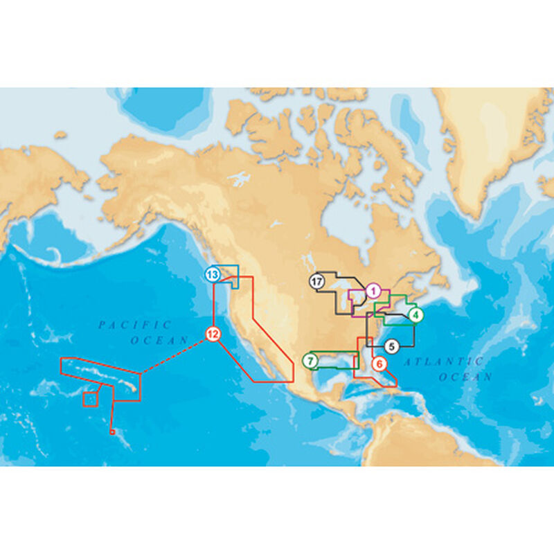
Navionics Platinum+ Cartography Charts, CF/904P+, (US Northeast & Canyons)
$379.99
")
Ship to Home
Delivery time calculated in checkout
Delivery time calculated in checkout
- This item is currently not available
Free Standard Shipping
This item is excluded from all discounts and promotions.
Minimum order quantity of
1
Maximum order quantity of
100
Must purchase in increments of
1

Return Policy
We believe in offering the very best value, quality, and selection. Plus, we want you to enjoy your purchase! In the event you wish to send a product back to us, you may return most unused items for a refund or exchange, minus shipping, within 90 days from the date of purchase unless noted below under exceptions and exclusions. Refunds are issued to the original form of payment.
Features
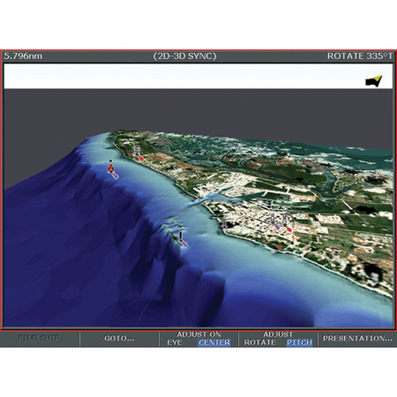
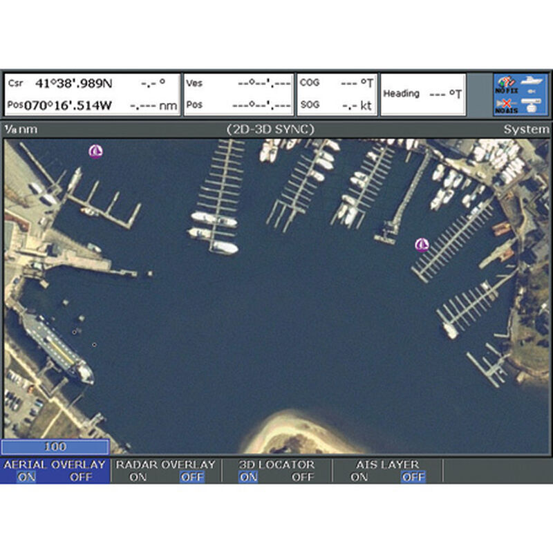
The new multidimensional charting and navigation cartography includes high definition, geo-referenced satellite, and high aerial top-down photography overlays in the highest available resolution. Sharp, panoramic pictures of marinas, ports, passes, and other locations in XGA (1,024 x 768) resolution; detailed 3D contours and bottom profiles; and high definition bathymetric data. Navionics has geo-referenced the entire US Coast Pilot guide. SD (Secure Digital) cartridge is compatible with Humminbird's 1,100/900 series models. CF (Compact Flash) cartridge is compatible with Lowrance's HDS series and Raymarine's E and G-series models.
- Multidimensional charting & navibation cartography
- High defintion, geo-referenced satellite
- High aerial top-down photography
- Sharp, panoramic pictures
- Detailed 3D contours and bottom profiles
Specs
Unit Weight
1.00 lb
Brand
Navionics
MFG Part No.
32867
 800-700-1366