Python Sailboat Stanchion Fender Hanger
Sale
$62.99
$89.99
30% Off

Ship to Home
Delivery time calculated in checkout
Delivery time calculated in checkout
- Back Order
FREE Standard Shipping over $99. | Good Sam Members: FREE Shipping over $69
This item is excluded from all discounts and promotions.
Minimum order quantity of
1
Maximum order quantity of
100
Must purchase in increments of
1

Return Policy
We believe in offering the very best value, quality, and selection. Plus, we want you to enjoy your purchase! In the event you wish to send a product back to us, you may return most unused items for a refund or exchange, minus shipping, within 90 days from the date of purchase unless noted below under exceptions and exclusions. Refunds are issued to the original form of payment.
Features
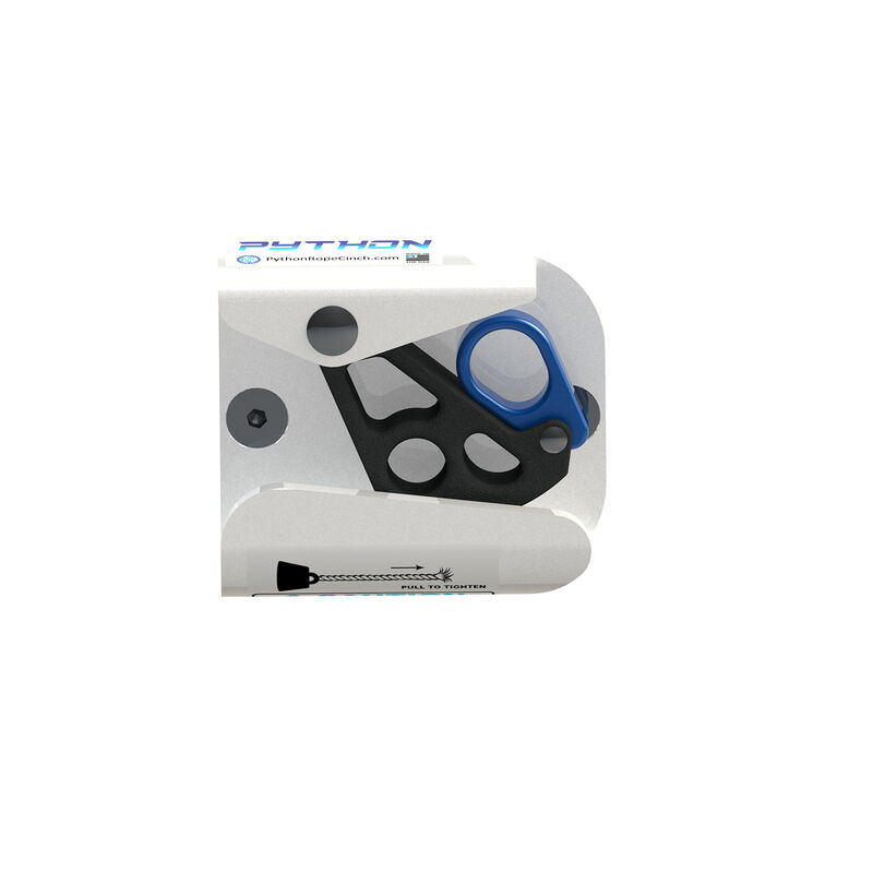
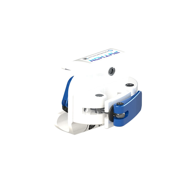
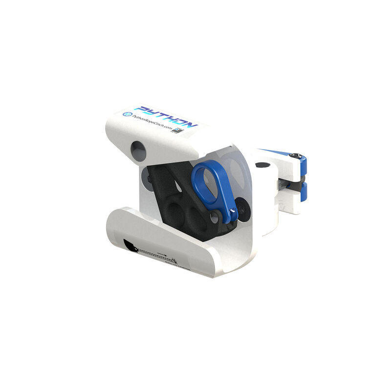
The Python Sailboat Fender Hanger enables you to secure a fender to the stanchion of your sailboat in seconds using rope sizes from 3/8” to 5/8”. Just pull up on the blue safety lever, keeping the gripping cam open, then insert the rope, and position as desired. Flip the blue safety level back down to allow the cam to grip the rope. To shorten the rope distance, simply pull on the rope. The rope will stay secure and lock back into place. To extend the distance or release the rope, pull on the rope to remove tension and then rotate the camo to release the rope. The supplied mounting bracket fits standard vertical and horizontal rails with diameters from 7/8” to 1-1/8”. Constructed of 6061 aircraft-grade, anodized aluminum with a powder-coat finish. Made in the USA. Model#: 3824-W.
- Secure a fender on the stanchion of your sailboat in seconds
- For use with rope sizes from 3/8" to 5/8"
- Mounting bracket fits standard vertical/horizontal rails 7/8" to 1-1/8" in diameter
- 6061 aircraft-grade, anodized aluminum construction with powder-coat finish
Specs
Material
Aircraft-Grade Anodized Aluminum
Quantity
1
Unit Weight
1.50 lb
Brand
Python
MFG Part No.
3824-W
 800-700-1366